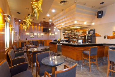
Bar nearby Mali Medo
Croatia
Bar nearby Mali Medo
Mali Medo
Tkalčićeva 36 Street, 10000, Zagreb, Kroatien
contacts phone
:
+385 1 4929 613
website:
www.pivovara-medvedgrad.hr
Latitude:
45.8158077
, Longitude:
15.9765237
larger map & directions
read more
nearest Bar
144 m
M&R
Ulica Ivana Tkalčića 53, Zagreb
Bar
read more
292 m
Plan B Bar
Ulica Ivana Tkalčića 84, Zagreb
Bar
read more
293 m
Playground Cafe Bar
Ulica Ivana Tkalčića 84, Zagreb
Bar
read more
293 m
Booze and Blues
Ulica Ivana Tkalčića 84, Zagreb
Bar
read more
395 m
Dubravkin put
Dubravkin put 2, Zagreb
Bar
read more
457 m
Zagreb Hostel
stara vlaska 5-7, Zagreb
Bar
read more
472 m
Kuća Pršuta
Vlaška ulica 33, Zagreb
Bar
read more
547 m
The Hole In One
Vlaška ulica 42, Zagreb
Bar
read more
637 m
La Cubanita Bar Zagreb
Vlaška ulica 48, Zagreb
Bar
read more
659 m
Gajba
Frankopanska ulica 9, Zagreb
Bar
read more
660 m
Karijola wine bar
Vlaška ulica 63, Zagreb
Bar
read more
689 m
Pizzerija Karijola Wine Bar
Vlaška ulica 61A, Zagreb
Bar
read more
721 m
Pivnica Medvedgrad Ilica
Ilica 49, Zagreb
Bar
read more
728 m
Mojo bar, wine rakija & co.
Martićeva ulica 5, Zagreb
Bar
read more
770 m
Cafe Bar Safari
Vlaška ulica 60, Zagreb
Bar
read more
774 m
Red Red Wine
Ulica Andrije Hebranga 30, Zagreb
Bar
read more
780 m
Hemingway Lounge Bar
Trg Republike Hrvatske 1, Zagreb
Bar
read more
780 m
Caffe Bar Mystic
Vlaška ulica 62, Zagreb
Bar
read more
861 m
Vivat fina vina wine bar
Martićeva ulica 17, Zagreb
Bar
read more
933 m
Valens caffe bar
Vlaška 79, Zagreb
Bar
read more
1.004 km
Noel Bar
Ulica Nikole Tomašića 13, Zagreb
Bar
read more
1.079 km
Cafe Galerija 14
Ulica Antuna Bauera 12, Zagreb
Bar
read more
1.215 km
The Public bar
Ulica kralja Zvonimira 11, Zagreb
Bar
read more
2.146 km
Butler Restaurant
Bunićeva ulica 7, Zagreb
Bar
read more
2.354 km
Studio Weddings and Events
Radnička cesta 27, Zagreb
Bar
read more
📑
all categories
Accounting
Administrative area level 1
Administrative area level 2
Airport
Amusement park
Aquarium
Art gallery
Atm
Bakery
Bank
Bar
Beauty salon
Bicycle store
Book store
Bowling alley
Bus station
Cafe
Campground
Car dealer
Car rental
Car repair
Car wash
Casino
Cemetery
Church
City hall
Clothing store
Convenience store
Courthouse
Dentist
Department store
Doctor
Electrician
Electronics store
Embassy
Finance
Fire station
Florist
Food
Funeral home
Furniture store
Gas station
General contractor
Grocery or supermarket
Gym
Hair care
Hardware store
Health
Home goods store
Hospital
Insurance agency
Jewelry store
Laundry
Lawyer
Library
Light rail station
Liquor store
Local government office
Locality
Locksmith
Lodging
Meal delivery
Meal takeaway
Mosque
Movie rental
Movie theater
Moving company
Museum
Natural feature
Neighborhood
Night club
Painter
Park
Parking
Pet store
Pharmacy
Physiotherapist
Place of worship
Plumber
Point of interest
Police
Post office
Premise
Real estate agency
Restaurant
Roofing contractor
Route
Rv park, camping
School
Shoe store
Shopping mall
Spa
Stadium
Storage
Store
Supermarket
Synagogue
Taxi stand
Train station
Transit station
Travel agency
University
Veterinary care
Zoo
administrative area level 3
sublocality level 1
↑